Solar Declination Calculator
Calculate solar declination, subsolar latitude, noon sun elevation, and the matching seasonal signal for any date and observer latitude on JSCalc-Blog.com.
Solar Position Results
Simple sine approximation
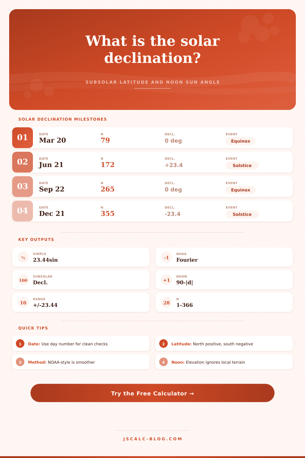
Declination ≈ 23.44 × sin((360 / 365) × (N - 81)), with the angle converted to radians before taking the sine.
This version is excellent for quick checks because it reaches about +23.44° near the June solstice, 0° near equinoxes, and -23.44° near the December solstice.
NOAA-style approximation
First compute fractional year γ = (2π / 365) × (N - 1). Declination in radians is then a small Fourier series using sin and cos terms through 3γ.
The calculator converts that radian result back to degrees, then treats the declination as the subsolar latitude.
Noon solar elevation
Geometric noon elevation = 90° - |observer latitude - declination|. Local horizon altitude is subtracted from the final practical clearance angle.
| Solar marker | Approx date | Day N | Declination | Subsolar point |
|---|---|---|---|---|
| March equinox | Mar 20 | 79 | About 0° | Equator |
| June solstice | Jun 21 | 172 | About +23.44° | Tropic of Cancer |
| September equinox | Sep 22 | 265 | About 0° | Equator |
| December solstice | Dec 21 | 355 | About -23.44° | Tropic of Capricorn |
| Latitude | Mar equinox | June solstice | Dec solstice | Interpretation |
|---|---|---|---|---|
| 0° | 90.0° | 66.6° | 66.6° | Equatorial overhead sun near equinox |
| 23.44° N | 66.6° | 90.0° | 43.1° | Tropic of Cancer overhead in June |
| 40° N | 50.0° | 73.4° | 26.6° | Strong seasonal noon-angle swing |
| 51.5° N | 38.5° | 61.9° | 15.1° | Low winter sun at London latitude |
| 66.56° N | 23.4° | 46.9° | 0.0° | Arctic Circle solstice boundary |
| 33.9° S | 56.1° | 32.7° | 79.5° | Southern seasons reverse northern labels |
Simple sine
Best for teaching, spreadsheet checks, and fast seasonal estimates. It follows the requested 23.44 × sin((360 / 365) × (N - 81)) approximation.
NOAA-style
Best for daily calculator use because the fractional-year Fourier terms better match the uneven apparent solar cycle.
Noon elevation
Both methods feed the same elevation rule: 90° minus the absolute distance between observer latitude and solar declination.
| Place or line | Latitude | Overhead sun? | Highest sun | Lowest sun |
|---|---|---|---|---|
| Equator | 0° | Near equinoxes | 90° | 66.6° |
| Tropic of Cancer | 23.44° N | June solstice | 90° | 43.1° |
| Tropic of Capricorn | 23.44° S | December solstice | 90° | 43.1° |
| New York City | 40.71° N | No | 72.7° | 25.8° |
| Singapore | 1.35° N | Twice yearly | Nearly 90° | 65.2° |
| Sydney | 33.87° S | No | 79.6° | 32.7° |
On summer days, sun is high up in the sky. In winter, the sun are low in the sky. Why? This is because of the geometry of how the earth sits on its axis. The earth’s axis has a current tilt of approximately 23.44 degrees.
That’s why it matters. That is the single most important piece of information to help you understand the pattern of daylight and solar energy. You can plug those into calculator above and do the math yourself. All that information are useless unless you know what the numbers mean.
How the Sun Moves
The point on earth where solar declination reaches 0º marks the place where the sun is directy overhead at noon. On the equinoxes, the point lie on the equator. Everywhere along that line the sun is vertical. During the year, the subsolar point slowly shifts northward toward the Tropic of Cancer or southward toward the Tropic of Capricorn. That shift produce the seasons.
It’s a tiny shift in terms of angular degrees, but it make a huge difference in amount of energy that hits your roof. It also makes big differences in the length of your own shadow. People greatly underestimate the effect of where they live (their own latitude).
For instance, if you’re in New York, which has a latitude of 40 degrees north, then the sun does not rise directly overhead. You’ll see it at an angle much lower than 90 degrees. In fact, the tool show exactly what your elevation at noon is compared to that moving subsolar point. That’s important, because it tells us just how far above you the sun is, and therefore how much atmosphere it must pass through.
Less atmosphere means more intense sunlight with less scattering; that’s why it’s brighter. But a shallow angle cause that same amount of energy to be spread out across more area. So it’s redder and weaker.
So what’s with the two calculations? There’s the straightforward sine approximation, which is simple, clear, and follows along easy. A simple phase shift captures the annual cycle. It’s great for classroom examples and quick estimates. It works well when it doesn’t matter if your answer isn’t perfectly right, as long as it is clear.
Then there’s the NOAA-style one, which incorporates a Fourier series to capture how Earth’s orbit isn’t a circle at all but an ellipse. That means that you’re moving faster around the Sun in winter months than summer ones. So the days aren’t evenly spaced. The complicated equation ironed out those wrinkles. It produces a result that matches actual observations more closely.
If you’re planning on building a solar array, you would of wanted this one; you want to know exactly when peak irradiance occurs.
And here’s a table on the page that indicates which way your noontime elevation will shift depending on what city you’re in. Notice, for example, the difference between Singapore and London. In winter, the sun never rises much higher then 15 degrees over London. That means it remains close to 90 degrees practically all year long in Singapore. This is why passively heated homes are effective up North but totally ineffective near the equator.
If you’re not near the tropics, don’t expect the sun to be high overhead. Work within your available angles. Horizon adjustments are practical applications of this.
In other words, the geometric calculation assumes a flat earth with a 0-degree horizon. What about reality? There aren’t many places in real life where that’s the case. A tree line, hill, or a tall building can blocks the sun. This happens even when the theoretical elevation is still positive.
What this does is add a horizon offset to the equation for you to see just how much usable sunlight there actualy is. You may calculate that the noon time sun is at 10 degrees but a neighboring roof block out anything less than 12 degrees. There is no direct sunlight at all.
And that’s the thing most folks miss. They concentrate on how high the sun is and don’t pay attention to what is standing in their way.
“Managing expectations” is what tracking the sun is all about. You know where it will be, because you know the path of the earth (predictable) and how the earth tilts (fixed). You can’t alter its tilt, but you CAN arrange your panels, mirrors, or windows so as to capture the available light.
That’s what you’re doing whether you use the complex Fourier series or something simpler like a sine wave. You’re lining up your structure to match the sky. And once you figure out the angle, it’s just geometry from there.