Satellite Ground Speed Calculator
Calculate orbital speed with v = sqrt(mu/r), orbital period, inertial surface-track speed, and approximate ground-track speed adjusted for body rotation and orbital inclination.
🛰Orbit presets
⚙Calculator inputs
Satellite ground speed results
🌍Body constants used
📊Orbit examples and checks
| Satellite case | Body | Altitude | Inclination | Approx ground-track speed |
|---|---|---|---|---|
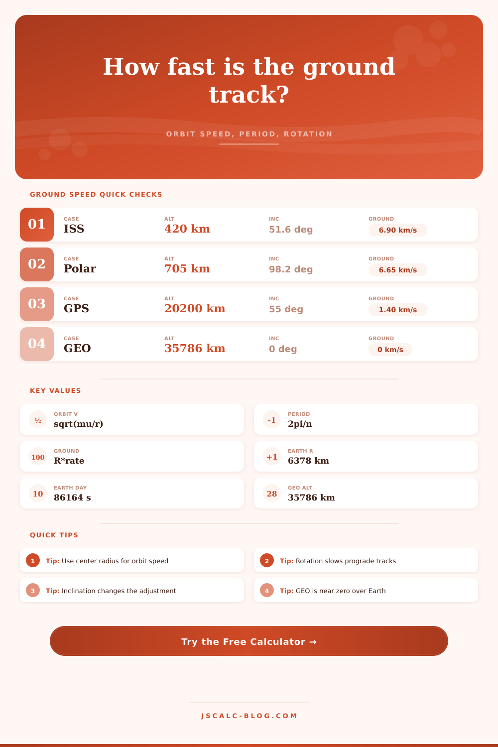
| ISS-like LEO | Earth | 420 km | 51.64° | About 6.90 km/s at equator crossing. |
| Sun-sync mapper | Earth | 705 km | 98.2° | About 7.63 km/s because retrograde motion works against rotation. |
| Polar LEO | Earth | 800 km | 90° | About 7.47 km/s from vector addition with rotation. |
| GPS MEO | Earth | 20,200 km | 55° | About 1.40 km/s surface-relative ground track. |
| Geostationary | Earth | 35,786 km | 0° | Near 0 km/s over the equator when orbital period matches rotation. |
| Low lunar orbiter | Moon | 100 km | 90° | About 1.59 km/s because the Moon rotates slowly. |
Ground-track speed is an approximation for circular orbits. Real ground tracks vary with latitude, eccentricity, oblateness, drag, maneuvers, and map projection.
📐Central body reference
| Body | mu (km³/s²) | Mean radius (km) | Rotation period | Equator rotation speed |
|---|---|---|---|---|
| Earth | 398600.4418 | 6378.137 | 23.9345 h | 0.465 km/s |
| Moon | 4902.8001 | 1737.4 | 655.728 h | 0.0046 km/s |
| Mars | 42828.3752 | 3396.19 | 24.6229 h | 0.241 km/s |
| Venus | 324858.592 | 6051.8 | -5832.5 h | 0.0018 km/s retrograde |
| Mercury | 22031.8686 | 2439.7 | 1407.5 h | 0.0030 km/s |
| Jupiter | 126686534 | 71492 | 9.925 h | 12.58 km/s |
🧮Formula method
💡Ground-track speed tips
When I think of a satellite, I imagine it to be a perfectly still object in space, silently surveying the earth below from on high. In truth, nothing could be further from the case. Geostationary satellites; which seem to hover motionless above the earth’s surface… Actualy cruise along thousands of kilometers per hour. They simply maintain a position above equator by rotating about the axis of the planet with perfect precision. Other satellites travel even faster, causing their path across the earth’s surface (called a “ground track”) to change completely with each overflight.
If you’re doing any kind of work involving reentry physics, communications, or remote sensing, you need to understand how to distinguish between your satellite’s ground speed versus its orbital speed. The calculator up top does the calculation for you; knowing what the numbers represent, however, will allow you to make sense of them.
Understanding Satellite Speeds
Before diving into any calculations, here’s the most important point: satellite mass has nothing to do with orbital speed; it depends only upon altitude. In space, a rocket stage falls as fast as feather does. Orbiting objects all move at the same rate. This rate is dictated solely by their distance from center of the central body and that body’s gravitational parameter (which essentially says how much gravity there is). A rookie mistake many people make is assuming surface altitude rather than total radius. Run calculation based off that number, and you’ll get an extremely wrong answer. To use the tool correctly, simply input your altitude number plus the radius of the body you’re near. The tool handles this calculation for you to avoid a major math error.
Now take that inertial orbital speed and consider how the planet’s rotation affects the ground track. That’s where the spinning planet enters the equation. We’re talking about Earth, which spins west-to-east. If you’re a satellite orbiting prograde (flying in the same direction), your ground speed will be lower than if you were standing on the ground; the ground itself is coming at you. If you’re a retrograde satellite, then your relative ground speed will be higher, because you’re going against the spin. Hundreds of meters per second are difference. This is huge for launch windows or radar coverage.
That is why the reference table on the page distinguishes between an equatorial orbit and a polar one. Another wrinkle in this is inclination. If the satellite orbits 90 degrees out (polar orbit), it move nearly perpendicular to the rotation vector. It receives little benefit from the rotation of the Earth, so it travels at nearly its full orbital speed over the ground. Satellites with low inclinations (like GPS) travel mostly parallel to the equator and is adjusted far more by the subduction of rotational motion. You can enter a latitude value into the calculator to determine how the ground track speed shifts depending upon where the satellite passes overhead. This is significant since the Earth’s surface rotation slows down as you move away from the equator toward the poles.
But how about geostationary orbit? That’s the true litmus test. About 35,000 kilometers high, a geostationary satellite has an orbital period equal to the Earth’s (sidereal) day. Its ground speed is effectively zero, even though it orbits at some three kilometers per second. It just hovers above one specific spot on equator. Change that altitude slightly and the satellite will appear to drift east or west. And that’s what makes the geostationary slots so tightly regulated.
And it’s not just other planets. Even the Moon doesn’t rotate fast at all, meaning that whatever you’re sitting on down there isn’t moving very fast relative to space. Your speed on the ground in an orbiting spacecraft around the moon would be pretty close to your orbital speed. On Mars the adjustment is more significant (closer to Earth’s rate) because it rotates faster. And then there is Venus which is a special case, spinning really slow and even backwards (retrograde). All of this reminds us again that orbital mechanics applies everywhere, not just on Earth. However, the constants vary.
This will help you imagine how your coverage pattern looks on the ground. A faster ground track means it moves across an area more quickly which leaves less time to collect data. The slower the track, the longer it dwells in place. It is a trade-off between observation time and coverage width. No way to get both with one satellite.
In summary, it’s simple math, but not simple intuition. Visualize the vectors. One vector is orbital velocity. Another is the surface rotation (spin) rate. Combine these to get the ground speed. It is a little thing, but it matters. Get it wrong and your mission design fails. Get it right, and you succeed. Numbers tell no lies, but numbers need context too. Adjust from the altitude for the spin, then follow along and see the ground track unfold. Same process, whether over Mars’ desert or the Pacific Ocean.