Geostationary Orbit Altitude Calculator
Compute the synchronous orbit shell from gravitational parameter, rotation period, and body radius, with speed, propagation delay, and Earth GEO look-angle checks.
Shell distance visualizer
A truly geostationary Earth satellite also needs near-zero inclination, near-zero eccentricity, and prograde equatorial motion.
Kepler's circular-orbit relation sets the radius from the center of the selected body. The surface altitude is the radius minus the selected body's mean radius.
| Body | mu (km³/s²) | Radius (km) | Sidereal rotation | Synchronous altitude |
|---|---|---|---|---|
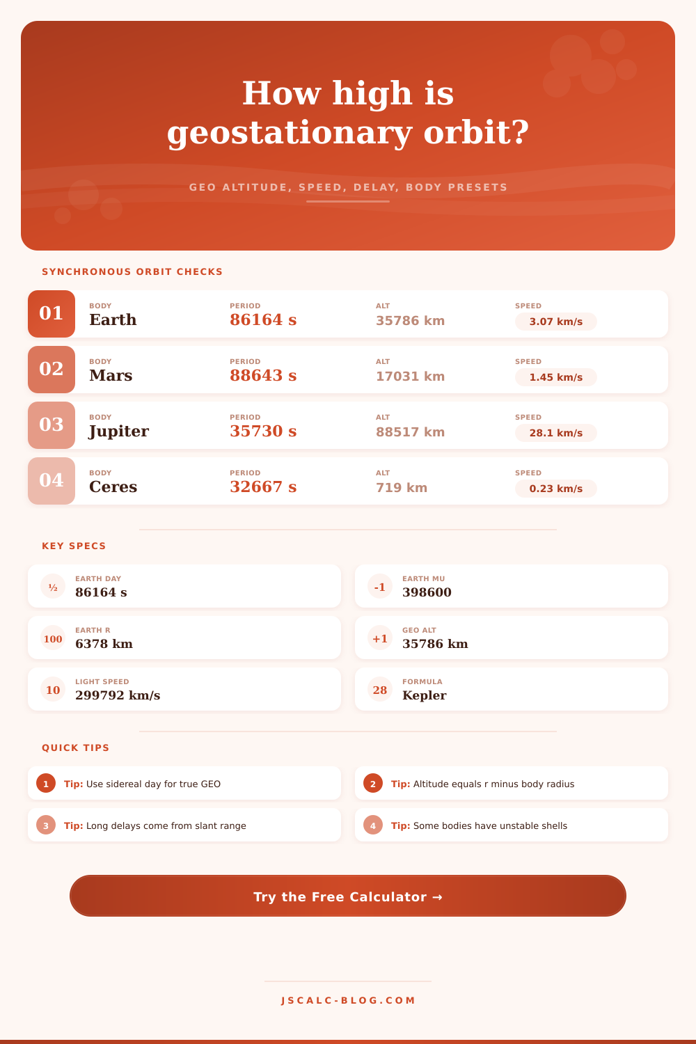
| Earth | 398,600.4418 | 6,378.137 | 86,164.0905 s | 35,786 km |
| Mars | 42,828.375 | 3,396.2 | 88,642.7 s | 17,031 km |
| Moon | 4,902.800 | 1,737.4 | 2,360,591.5 s | 86,715 km |
| Mercury | 22,032.080 | 2,439.7 | 5,067,031.7 s | 240,445 km |
| Venus | 324,858.592 | 6,051.8 | 20,996,798 s | 1,530,499 km |
| Jupiter | 126,686,534 | 71,492 | 35,729.7 s | 88,517 km |
| Saturn | 37,931,208 | 60,268 | 38,362 s | 51,972 km |
| Uranus | 5,793,939 | 25,559 | 62,064 s | 57,127 km |
| Neptune | 6,835,100 | 24,764 | 57,996 s | 58,744 km |
| Ceres | 62.628 | 473 | 32,667 s | 719 km |
| Orbit class | Typical altitude | Period | Speed | Signal note |
|---|---|---|---|---|
| Low Earth orbit | 400 km | 92.6 min | 7.67 km/s | About 1.3 ms vertical |
| Sun-synchronous LEO | 705 km | 98.8 min | 7.50 km/s | Fast moving pass |
| GPS medium orbit | 20,200 km | 11.97 hr | 3.87 km/s | About 67 ms vertical |
| Earth GEO sidereal | 35,786 km | 23.934 hr | 3.07 km/s | About 119 ms vertical |
| Earth 24-hour test | 35,913 km | 24.000 hr | 3.07 km/s | Slightly higher than GEO |
| Lunar distance | 384,400 km | 27.3 days | 1.02 km/s | About 1.28 s one-way |
| Ground latitude | Longitude offset | Slant range | One-way delay | Elevation angle |
|---|---|---|---|---|
| 0° | 0° | 35,786 km | 119 ms | 90.0° |
| 30° | 0° | 36,779 km | 123 ms | 55.0° |
| 45° | 0° | 37,923 km | 127 ms | 38.2° |
| 45° | 30° | 38,589 km | 129 ms | 30.3° |
| 60° | 0° | 39,365 km | 131 ms | 21.9° |
| 70° | 0° | 40,429 km | 135 ms | 11.5° |
| Term | Meaning | Unit used | Calculator step |
|---|---|---|---|
| mu | Standard gravitational parameter, G times body mass | km³/s² | Sets gravitational pull |
| T | Chosen synchronous period | seconds | Converted from selected period unit |
| r | Orbital radius from body center | km | (mu * (T / (2*pi))^2)^(1/3) |
| h | Altitude above mean surface | km | r minus body radius |
| v | Circular orbital speed | km/s | sqrt(mu / r) |
| delay | Vacuum propagation delay | ms | path divided by light speed |
Imagine that you’re standing on Earth and there’s a satellite right over your head, parked perfectly still in the sky. For months, maybe even years, it won’t budge by so much as an inch. That’s because it’s in what we call a geostationary orbit.
But why? Why is this particular shell at exactly the altitude where its orbital period matches the rotation of our planet below it? Go up further: Drift east. Go down farther: Race ahead. The math must be just right.
How Satellites Stay in Place
That’s what Kepler’s third law is doing here, and while you don’t have to memorize the equation, knowing how it works can help you believe in the answer that it produces. Basically it starts with the gravitational parameter of the body, which along with its rotation period, give us a radius at which gravity and centrifugal force are balanced. Then we subtract off the radius of the body, resulting in an answer: the altitude above the surface.
This is important. Mission planners think in terms of distance from the center when they talk about orbital mechanics, but engineers who design launch profiles thinks in terms of altitude above ground. Kepler’s third law is the bridge there. The calculator above simply applies it to the work for you.
Here’s where everyone screws up and it’s so easy. You think that something in a geostationary orbit have an orbital period of exactly 24 hours. Nope. There’s what we call a solar day (24 hours), and there’s what we call a sidereal day (about four minutes less). So if you’re computing orbits at tens or hundreds of thousands of kilometers, that matters. The calculator defaults to the sidereal period; that’s the right number for a real geostationary lock. Switching to solar mode with 24 hour periods makes the altitude go up by ~127 kilometers. Over time it’d just creep westward compared to stars. Most folks forget that bit.
Another key output is signal delay. Remember, radio waves move at speed of light, but the speed of light isn’t infinitely fast. At 35,786 kilometers (satellite altitude), it takes roughly 119 milliseconds for a signal to go up and down, each way. That’s non-trivial. You’ll notice it, as if your online games have a bit of a lag. It could also be your phone call.
And because satellite locations can be off-set in east-west position or at higher latitudes, that slant range gets longer. So does the delay. As elevation gets higher, the numbers change to match. This is laid out in the reference tables on the page. Physics doesn’t lie. And it depends on distance.
But let’s look to the rest of our solar system. Because Mars rotates more slowly than Earth, its Areostationary point must be significantly closer. It’s only ~17,000 kilometers up. On the opposite side is Jupiter. It spin super-fast, resulting in a very distant synchronous shell.
But that’s where the Moon really stands out. Its spin is so slow that an orbit matching its rotation would lie far outside the Moon’s sphere of influence. As the calculator demonstrates, you need an altitude of several hundred thousand kilometers. In reality, this makes it impossible to have a stable synchronous shell orbit around the Moon for any satellite. It is mathematically possible but environmentally impossible.
What does the altitude have to do with you? When you want to design your own antenna, the elevation angle determines what kind of hardware you’ll need. To see that satellite near the horizon means using a higher gain antenna, since that’s where you get ground noise and more atmosphere between you and the bird. Use the calculator and it will tell you what look angles you’re going to have from your location. Is the satellite visible or not?
For example, if you live at 70 degrees latitude, then the satellite appears low on the southern horizon. You better have a clear shot. Trees and buildings can pose big problems.
There’s another price to pay for this orbit: station keeping. Getting there is one thing; staying there is another. There are tiny tweaks necessary all the time. The satellite is being tugged on by gravitational disturbances caused by sun and moon. It gets pushed around by solar radiation pressure. The nominal shell isn’t enough. Reality adds friction. Fuel needs to be budgeted to keep it in place. Otherwise it will gradually drift off into an unusable graveyard orbit, or worse.
And then finally, there’s geostationary orbit. It is a fine line in space. Motion matches gravity there. Where satellites stays fixed over a spot on Earth. These pages are all the tools needed to find your fine line in space around any rotating, heavy body.
You want to know where it is for Mars? Or you’re thinking of putting up a communications link? Same deal. Find the matching period to the rotation. Account for the signal delay. And remember: always look at sidereal time. That’s what keeps your satellite up in the sky.