Local Sidereal Time Calculator
Convert UTC date, UTC time, and observer longitude into Julian Date, GMST, local sidereal time, and target hour angle.
📍Real Observatory Presets
⚙Calculator Inputs
Sidereal Time Results
🧭Sidereal Time Quick Facts
🔢Formula Breakdown
1. Julian Date: convert the UTC date and time to JD. The calculator uses the Unix epoch relationship JD = UTC milliseconds / 86400000 + 2440587.5.
2. Days from J2000.0: D = JD - 2451545.0.
3. Greenwich sidereal time: GMST = 18.697374558 + 24.06570982441908 x D, then normalized into the 0-24 hour range.
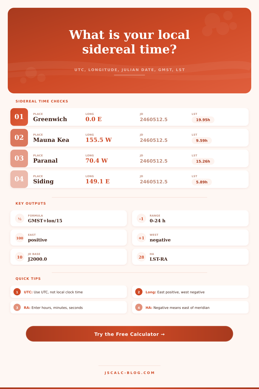
4. Local sidereal time: LST = GMST + longitude / 15 hours, with east positive, then normalized into 0-24 hours.
5. Hour angle: hour angle = LST - RA. The displayed signed value is normalized to -12 through +12 hours.
🌐Longitude Sign Reference
| Location type | Sign | Example longitude | LST effect |
|---|---|---|---|
| Greenwich meridian | 0 | 0.0000° | LST equals GMST |
| Eastern hemisphere | Positive | 149.0661° E | Add 9.9377 hours |
| Western hemisphere | Negative | 155.4681° W | Subtract 10.3645 hours |
| International Date Line east side | Positive | 179.0000° E | Add 11.9333 hours |
| International Date Line west side | Negative | 179.0000° W | Subtract 11.9333 hours |
🔭Observatory Longitude Table
| Observatory | Country or region | Longitude used | Longitude hours |
|---|---|---|---|
| Royal Observatory Greenwich | United Kingdom | 0.0000° E | +0.0000 h |
| Mauna Kea Observatories | Hawaii | 155.4681° W | -10.3645 h |
| Paranal Observatory | Chile | 70.4042° W | -4.6936 h |
| Cerro Tololo Inter-American Observatory | Chile | 70.8065° W | -4.7204 h |
| Atacama Large Millimeter Array | Chile | 67.7549° W | -4.5170 h |
| Very Large Array | New Mexico | 107.6184° W | -7.1746 h |
| Siding Spring Observatory | Australia | 149.0661° E | +9.9377 h |
| Sutherland SAAO | South Africa | 20.8107° E | +1.3874 h |
| McDonald Observatory | Texas | 104.0216° W | -6.9348 h |
| Roque de los Muchachos | La Palma | 17.8792° W | -1.1919 h |
⏱Hour Angle Interpretation
| Signed hour angle | Target position | Meridian timing | Typical use |
|---|---|---|---|
| -6 h | East of meridian | Transits in about 6 sidereal hours | Rising-side planning |
| -3 h | East of meridian | Transits in about 3 sidereal hours | Good pre-transit window |
| 0 h | On meridian | Transiting now | Maximum altitude check |
| +3 h | West of meridian | Transited about 3 sidereal hours ago | Post-transit tracking |
| +6 h | West of meridian | Transited about 6 sidereal hours ago | Setting-side planning |
📐Common Conversion Table
| Quantity | Hours | Degrees | Notes |
|---|---|---|---|
| 1 sidereal hour | 1 h | 15° | Longitude conversion factor |
| 1 sidereal minute | 0.016667 h | 0.25° | Four minutes per degree |
| 1 sidereal second | 0.000278 h | 0.004167° | Small pointing offset |
| 6 sidereal hours | 6 h | 90° | Quarter of a full circle |
| 12 sidereal hours | 12 h | 180° | Opposite side of sky |
| 24 sidereal hours | 24 h | 360° | Full right ascension circle |
⚖Comparison Grid
💡Practical Tips
Amateur astronomers are all familiar with the instant of terror. You’re standing out in the cold, peering through telescope tube up at a starry sky, and you don’t know what’s up there. Why? Because we think like clock-watchers do (the kind whose hands go around in a circle once every 24 hours), but the sky runs on a different schedule entirely.
The solution is local sidereal time. It links the two. It tells you exactly what part of the sky is passing directly overhead at any given moment, like a strip of darkness that can be read as a map.
How to Use Sidereal Time for Stargazing
We think like clock-watchers, who use clocks that go around in a circle once every 24 hours, but the sky does not run on this so-called “solar time” at all. The solution is local sidereal time, which links the two and informs you precisely what part of the sky is passing directly overhead at any given instant, a swath of blackness that becomes readable as a map.
So what’s the underlying problem? A sidereal day is the time it takes for the earth to face the same position in space. This is about four minutes shorter then a solar day, which is the time for the sun to return to the same point in the sky. Since we spin as we go around the sun, every day we has to turn an extra little bit before facing the sun again. This builds up over the course of one night. When you’re trying to follow the stars, if you set your watch by the sun, you’ll end up being out by minutes.
The calculator does all the math for you. It takes your observer longitude and UTC date and changes them to the exact Greenwich Mean Sidereal Time and Julian Date necessary to determine where the sky lies over you. In other words, it takes guesswork out of doing the conversions.
The part where people screw up, which will break the whole calculation; is entering their own longitude. East is positive, while west is negative. Why? Because we want to know if we should add or subtract time from the Greenwich baseline. For example, if you’re standing on Mauna Kea in Hawaii looking out at the universe, you have a western longitude so you subtract hours. Standing on Siding Spring, Australia, you add them. To use the tool, those get made standard so you can just enter them and not care what the sign is, but you must understand how it works so you trust the results. Get the sign reversed and you’ll be looking for Orion with Polaris dead overhead.
Now comes the fun part. Take your calculated Local Sidereal Time and plug it into the app. Then you match it with the objects’ right ascension. Right ascension can be thought of as longitude represented on the sky. So when your Local Sidereal Time equals an object’s right ascension, you have that object on your local meridian. In other words, it’s directly overhead. This is your best viewing window.
The resulting output of hour angle will tell you how far away from that peak you currently are. If you get a minus number for hour angle, then the object hasn’t crossed the meridian yet. But if you recieve a plus number, it’s past the point of maximum elevation. That lets you schedule to match atmospheric conditions.
Observing objects close to their transit is always better; atmospheric turbulence is worst closer to the horizon. You don’t want something setting in the west or creeping up on the eastern horizon while you chase it around. You want something high and steady. That’s where the calculator comes into play: it gives you the hour angle to assist with this judgment call. It takes abstract coordinates and translates them into time you can act on. Glance at the signed hour angle and instantly you’ll know whether you’ve got ten hours or ten minutes of best viewing left.
Finally, daylight saving time can be a sneaky little devil. When entering the time on your watch for the calculation, make sure it’s in UTC (not your local civil time). Otherwise, you’ll be an hour off if it’s summer when you do the calculation. That will add to the sidereal drift and cause real trouble. First convert to UTC. One extra step, but there’s no other way to get an accurate Julian Date.
And this one uses J2000.0 as its epoch. That’s just a reference point. It prevents the precession calculations from slowly drifting, which keeps the positions of the stars aligned with the time stamp.
So in conclusion: Sidereal time is simply a star-based clock. It doesn’t alter position of the constellations. But it gives you the words to predict where they will be. Once you understand how the celestial equator relates to your location on Earth and to universal time, you won’t feel like you’re guessing at the sky anymore; you’ll know how to navigate it. And when you go outside again, you’ll know exactly what’s above you. What’s heading toward the western horizon? What’s coming up next? If you speak its language, the universe makes sense and is predictable.