Land Parcel Area Calculator
Calculate parcel area from boundary dimensions or coordinates, subtract exclusions and easements, apply usable percentage, adjust for slope, split by parcel count, and convert between square feet, acres, hectares, and square meters.
Changing units converts the current dimensions and exclusion entries.
Choose the method that best matches the boundary information you have.
Use ordered boundary points around the parcel. The calculator closes the polygon automatically.
Enter wetlands, reserved pads, water, or areas outside the legal parcel.
Subtract utility, driveway, drainage, or shared access easements.
Apply after explicit exclusions and easements are removed.
Surface factor = square root of (1 + slope ratio squared).
Use whole planned parcels, phases, or equally sized lots.
All four land units are still shown in the results.
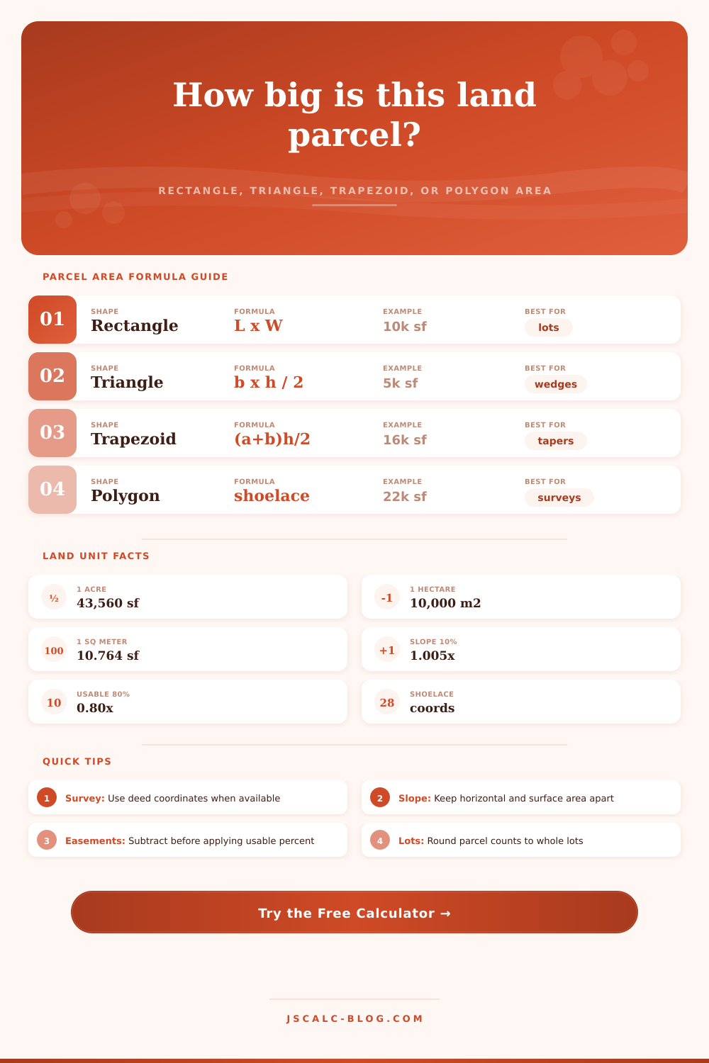
| Method | Inputs | Formula | Best Use | Common Check |
|---|---|---|---|---|
| Rectangle | Length and width | L x W | Platted rectangular lots | Opposite sides should match |
| Triangle | Base and perpendicular height | b x h / 2 | Corner remainders and wedges | Height is not the sloped side |
| Trapezoid | Two parallel sides and height | ((a+b)/2) x h | Tapered lots and strips | Only a and b are parallel |
| Polygon | Ordered x,y coordinates | Shoelace / 2 | Survey sketches and irregular parcels | Points must go around perimeter |
| Net area | Gross minus deductions | gross - excluded - easement | Buildable screening | Do not double count easements |
| Slope surface | Usable area and slope | usable x sqrt(1+s^2) | Seeding, clearing, surface planning | Horizontal deed area stays unchanged |
| Unit | Square Feet | Acres | Square Meters | Hectares |
|---|---|---|---|---|
| 1 square foot | 1 ft² | 0.00002296 ac | 0.092903 m² | 0.00000929 ha |
| 1 square meter | 10.763910 ft² | 0.000247 ac | 1 m² | 0.0001 ha |
| 1 acre | 43,560 ft² | 1 ac | 4,046.856 m² | 0.404686 ha |
| 1 hectare | 107,639.104 ft² | 2.471054 ac | 10,000 m² | 1 ha |
| 1 square mile | 27,878,400 ft² | 640 ac | 2,589,988 m² | 258.999 ha |
| Scenario | Method | Gross Area | Deductions | Usable % | Slope | Parcel Count | Typical Use |
|---|---|---|---|---|---|---|---|
| Suburban 80 x 125 lot | Rectangle | 10,000 ft² | 0 ft² | 92% | 3% | 1 | Residential lot check |
| Quarter acre homesite | Rectangle | 10,890 ft² | 650 ft² | 86% | 6% | 1 | Setback screening |
| Flag lot with easement | Polygon | 34,025 ft² | 3,100 ft² | 84% | 4% | 1 | Access strip impact |
| Triangular corner lot | Triangle | 7,700 ft² | 300 ft² | 88% | 5% | 1 | Irregular corner parcel |
| Tapered rural parcel | Trapezoid | 48,400 ft² | 1,200 ft² | 90% | 8% | 1 | Tapered frontage lot |
| Five acre homestead | Rectangle | 217,800 ft² | 12,000 ft² | 78% | 12% | 1 | Rural site planning |
| Commercial pad site | Trapezoid | 71,750 ft² | 8,500 ft² | 82% | 2% | 2 | Pad and easement review |
| 40 acre field split | Rectangle | 1,742,400 ft² | 64,000 ft² | 94% | 3% | 4 | Equal tract split |
| Metric hectare block | Rectangle | 107,639 ft² | 5,382 ft² | 88% | 7% | 3 | Metric land record |
| Input Choice | Math Effect | Example | Result | Planning Note |
|---|---|---|---|---|
| Exclusion area | Subtract first | 10,000 - 600 | 9,400 ft² | Use for non-parcel or protected area |
| Easement area | Subtract with exclusions | 9,400 - 400 | 9,000 ft² | Use for access and utility strips |
| Usable percent | Multiply net area | 9,000 x 80% | 7,200 ft² | Use for buildable or workable land |
| 10% slope | Surface factor 1.005 | 7,200 x 1.005 | 7,236 ft² | Surface estimate, not deed area |
| 25% slope | Surface factor 1.031 | 7,200 x 1.031 | 7,423 ft² | Useful for clearing or planting area |
| Parcel count 4 | Divide final area | 7,200 / 4 | 1,800 ft² | Assumes equal area parcels |
You stand on a corner lot with a phone in one hand and a survey map in the other, wondering if there’s enough space for that detached garage. Intuition tells you one thing; deed tells you something else. By dividing physical land that you’ll be working with from legal paper area, you’re bridging the gap between these two worlds.
That’s where most folks end the gross area calculation. They just take length x width of their lot if it’s a rectangle and say good enough. Nothing wrong with doing this on a nice even rectangle in a flat subdivision. In reality, however, land doesn’t behave like that. Land may have a steep slope eating away at buildable area. Land may have utility strips or wetland areas that is legally yours but practically aren’t. Land may have easements that cut across the back yard.
How to Calculate Your Land Area Correctly
Once you feed your measurements into the tool above, it do the math for you, sparing you any need to wrestle with geometric formulas while out on the site. Choose the shape method that best describes how you got your data. If your lot is triangular or some other weird polygon, a rectangle formula won’t work for you. If your plot has any complexity, then the shoelace formula and coordinates are the way to go, as they capture its true boundary without forcing it into a box-shaped square. Entering it yourself manually will take longer but be a lot more precise than estimating with a tape measure along angles and curves. Choose method that matches what boundary lines you already have.
This is the subtraction part, and it’s when many amateur estimations goes wrong. Before calculating what can be built upon, subtract the easements from the calculation. Easements are spaces you own but may not build upon. If you ignore them, you might find that your garage sits on top of a power company access strip or a drainage pipe. Subtract those areas first to get a net horizontal number. This number reflects your true legal right instead of just your total perimeter coverage.
You subtract easements first. Then you apply setbacks from the street, side yards, and local zoning requirements that determines where buildings may sit. That includes setbacks from the street, any setbacks from side yard, and local zoning requirements that determine where buildings may sit. It’s an approximation of what can actualy be built. Your “lot” might appear large on paper, but if a lot needs to be set aside as open space by ordinance then your actual area shrinks significantly.
Then there’s the other layer that trips a lot of buyers up: adjustment for slope. Deed records use horizontal area, and therefore the slope doesn’t alter your acreage as recorded in the title. But when you want to grade it or mow grass and cut back brush, then you’re working with surface area. Ten percent means a little more real ground cover. It sounds small until you do it over five acres. That additional square footage will add up in material cost whether you pave or seed.
The last thing is unit conversion. Regardless of whether your preferred unit is square feet, hectares, or acres, the math is still the same. The area of land doesn’t change based off which unit you choose to use; it’s simply a matter of communication. If you work with contractors around the world (or compare listings across various regions), being able to fluently switch between metric and imperial measurements will come in handy.
So the trick is really knowing what the number represents. Does it mean the legal line? The build-able footprint? Or does it mean the actual surface of the ground? All three are used at some point in the planning process but once you tease them apart, those numbers cease to be abstract information and become decisions: How much seed should of I purchase? Where does the garage go? Will my dream fit on this plot before signing anything?