Declination Altitude Calculator
Calculate upper meridian transit altitude from observer latitude and object declination, then check lower culmination, circumpolar status, never-rises cases, and usable visibility windows.
📍Real Sky Presets
⚙Calculator Inputs
Altitude Results
🧮Formula Breakdown
The upper meridian altitude is the object's highest altitude when it crosses the observer's meridian. Latitude and declination must use the same north-positive sign convention.
| Quantity | Formula | Meaning | Use |
|---|---|---|---|
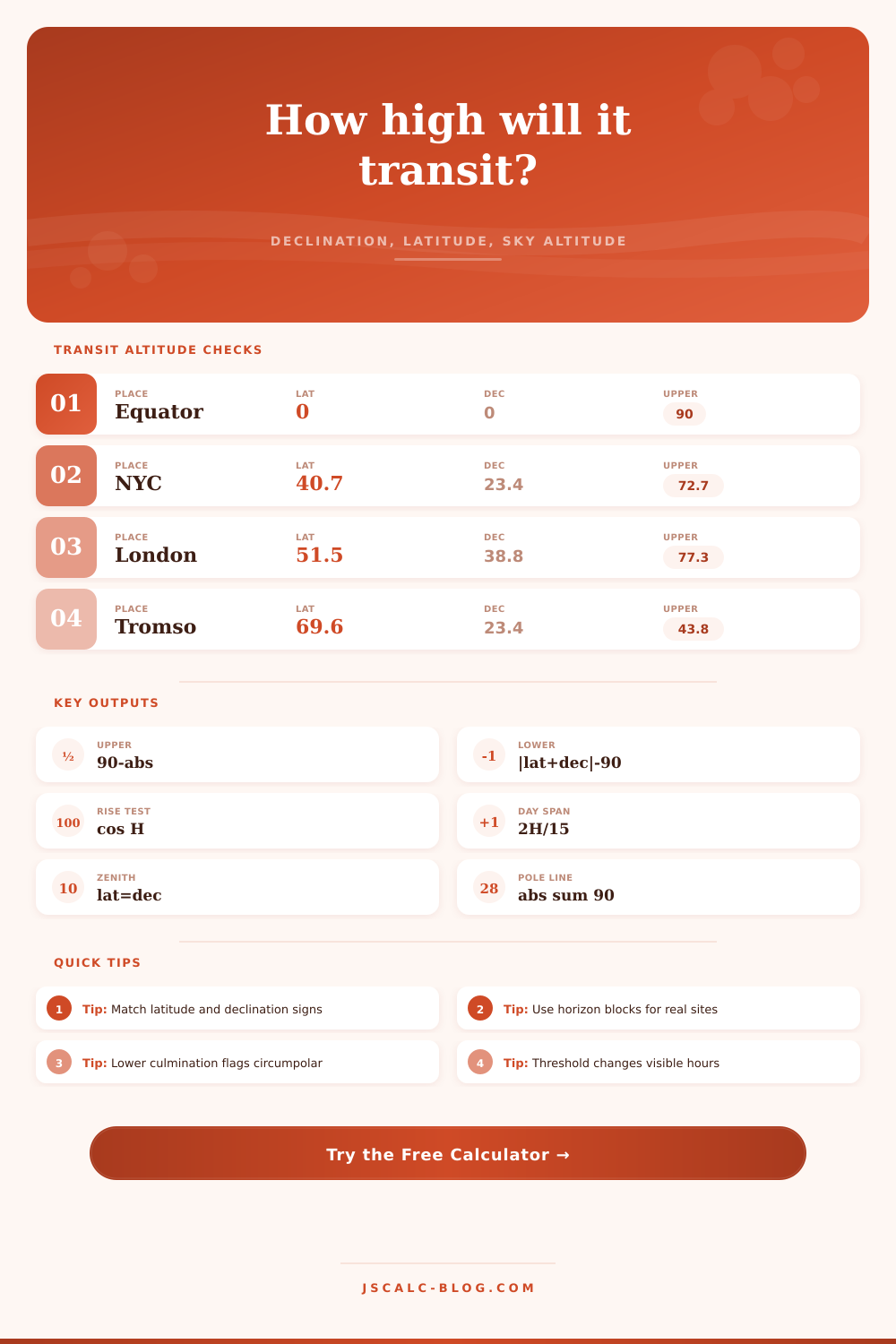
| Upper transit altitude | 90 - abs(φ - δ) | Highest meridian altitude | Object height at culmination |
| Lower culmination | abs(φ + δ) - 90 | Opposite meridian altitude | Circumpolar check |
| Rise and set hour angle | acos((sin h0 - sinφ sinδ) / (cosφ cosδ)) | Sky arc above threshold | Visibility window |
| Window duration | 2H / 15 | Hours above threshold | Sidereal-hour estimate |
| Circumpolar rule | same sign and absφ + absδ > 90 | Never sets geometrically | High latitude planning |
| Never-rises rule | opposite signs and absφ + absδ > 90 | Always below horizon | Target feasibility |
📊Comparison Grid
🌍Transit Altitude Reference
| Scenario | Latitude | Declination | Upper Altitude | Sky Context |
|---|---|---|---|---|
| Equator at equinox | 0.0° | 0.0° | 90.0° | Object passes through zenith |
| New York, June Sun | 40.7° | +23.4° | 72.7° | High summer noon Sun |
| New York, December Sun | 40.7° | -23.4° | 25.9° | Low winter noon Sun |
| London, Vega | 51.5° | +38.8° | 77.3° | Nearly overhead summer star |
| Sydney, Acrux | -33.9° | -63.1° | 60.8° | Prominent southern circumpolar star |
| Tromso, June Sun | 69.6° | +23.4° | 43.8° | Midnight Sun season |
| Tromso, December Sun | 69.6° | -23.4° | -3.1° | Polar night geometry |
| Mauna Kea, Polaris | 19.8° | +89.3° | 20.5° | Near north celestial pole |
👁Visibility Window Context
| Threshold | What It Means | Best Use | Effect on Window |
|---|---|---|---|
| Effective horizon | Horizon minus refraction correction | Rise, set, daylight length, basic visibility | Longest practical window |
| 10° altitude | Above many trees and rooftops | General backyard observing | Removes low, murky sky time |
| 20° altitude | Moderate airmass and cleaner horizon | Planets, lunar details, bright deep-sky | Shorter but steadier window |
| 30° altitude | Higher quality observing zone | Imaging, faint targets, precise viewing | Only the central sky arc remains |
🧭Latitude And Declination Patterns
| Latitude Band | Same-Hemisphere Declination | Opposite-Hemisphere Declination | Planning Note |
|---|---|---|---|
| Equator, 0° | Every declination rises and sets | Every declination rises and sets | Transit altitude equals 90° - abs(declination) |
| Mid-latitudes, 25° to 55° | High transits and some circumpolar stars | Lower transits, short windows near the far pole | Use lower culmination to find all-night targets |
| High latitudes, 55° to 66.6° | Large circumpolar zone | Large never-rises zone | Small declination changes strongly affect visibility |
| Polar circles, beyond 66.6° | Seasonal always-up Sun or circumpolar stars | Seasonal never-rises Sun or hidden stars | Window checks may return 0 or 24 hours |
📝Preset Details Table
| Preset | Object Type | Latitude | Declination | Why It Matters |
|---|---|---|---|---|
| Equator Equinox Sun | Sun | 0.0° | 0.0° | Shows the zenith case directly from the core formula. |
| New York June Sun | Sun | 40.71° | +23.44° | Summer noon altitude and long daylight window. |
| New York December Sun | Sun | 40.71° | -23.44° | Low winter culmination and short daylight window. |
| London Vega | Bright star | 51.51° | +38.78° | High northern summer star with long visibility. |
| Sydney Acrux | Bright star | -33.87° | -63.10° | Southern Cross star that stays above Sydney's horizon. |
| Tromso Midnight Sun | Sun | 69.65° | +23.44° | Demonstrates a circumpolar Sun at high northern latitude. |
| Tromso Polar Night | Sun | 69.65° | -23.44° | Demonstrates a never-rising winter Sun. |
| Mauna Kea Polaris | Bright star | 19.82° | +89.30° | Near-pole target altitude closely tracks observer latitude. |
| Ushuaia Canopus | Bright star | -54.80° | -52.70° | Very high southern transit with circumpolar behavior. |
| Singapore Orion Belt | Bright star | 1.35° | -1.20° | Near-equator target that culminates almost overhead. |
Sometimes you’re standing on a hillside and watching the sun set, and you know: that thing is going down. But where exactly does it go? The answer to that is pure geometry. And it’s the geometry that tells you when to expect the stars you want… And instead see nothing more than black outline of your neighbor’s roof.”
The simple math of the sky calculates altitude from both latitude and declination. From there, you know how high the object will climb in the sky and for how long. Using a planisphere is mostly guessing; it works because most everyone else guesses too. Instead, the calculator above do the exact trigonometry for you, letting you plan based on real numbers different than fuzzy hopes.
The Simple Math of the Sky
There’s one beautiful equation at the heart of it all. The altitude of any object’s transit depends on an angle between the object’s declination… Which fixes its position relative to the celestial equator, and your own latitude, which fixes your horizon on the celestial sphere. And how can I forget? It’s the celestial sphere!) Put another way: Knowing where you sit (latitude) determines your own personal horizon; knowing an object’s declination tells you where on the sphere it is. From there, it’s a simple matter of trigonometry to calculate the transit altitude.
If you’re at forty degrees of latitude and you observe a twenty-degree-declination star, for instance, you know it’ll never rise above the zenith. It will stay in the south, appearing at its lowest point when it passes overhead. Why does this matter? Because the farther an object slides down toward the horizon, the more distorted by the atmosphere it becomes. Something that transits at sixty degrees altitude appear clear and bright, while something passing at ten degrees is dim and fuzzy.
That’s when many people get tripped up: by understanding the sign conventions. Positive means northern and negative means southern. This applies to both latitude, which is the place we’re at, and declination, which is the angle the thing we want to see lies on. Get those signs wrong, and you’ll compute yourself a transit taking place in the wrong half of the sky altogether. The tool handles it, yes, but having the logic in your head makes it easier to spot mistakes.
There’s an interesting condition: when your own latitude and the object’s declination has the same sign as each other, and when their absolute values add up to greater than 90 degrees. What then? That object doesn’t set. It’s circumpolar; it travels around the pole during the night. And this is the magic of observing from high latitudes: During the summer in Tromso, Norway, for instance, the sun acts this way, circling the horizon but never dropping below it to produce the midnight sun. During the winter, the sun doesn’t rise at all; it does the reverse. These aren’t exceptions to the rule; they’re the rule being pushed to its extreme.
Also consider what’s blocking your view. In most real-world situations, there isn’t a perfect geometric horizon. Buildings, mountains, and trees gobble up the lower degrees of altitude. It may not seem like a lot to add five degrees of obstruction to your calculation. However, if you are trying to see something at a shallow rising angle, it will slice off an hour or two from your visibility window. That’s where the local horizon limit comes into play, and why it’s important for urban observers: whatever blocks your view in the backyard won’t let you see things peaking just three degrees above the horizon, regardless of length of the theoretical window. You want altitude.
Another not-so-obvious factor: The atmosphere bends light, which makes things below the geometric horizon appear as if they are higher than they actualy are. Standard refraction near the horizon is about thirty-four arcminutes. That means you’ll see the sun before it’s even there, which doesn’t sound like a bad thing, but it makes accurate timing tricky. You can turn this on or off in the calculator, which will make your predictions more or less precise. If you’re trying to hit an exact time (say for a lunar occultation or other solar event) you have to account for this, but if you just want to go out and look around, you won’t miss anything by turning it off. How picky are you?
From there you can estimate what kind of view you will have at that altitude. Higher is better because there’s less atmosphere between you and it, so less to twinkle through and more saturated colors. Lower is…well, you’re fighting extinction. The visibility window is how long it is visible above your desired altitude. With that you can see the amount of time you’ll have available. Want 30-degrees of altitude to do astrophotography? You’re greatly reducing your window versus a zero-degree threshold. Choose quality over quantity.
On the flipside is the culmination check at the bottom. It shows the object’s lowest point reached for circumpolar objects. A positive number means it’s never under the horizon and a negative number means it goes down below the horizon. It is useful for determining whether an object will be up all night or if there is a specific time window to see it.
It’s just a matter of remembering: The sky is a clock that doesn’t stop ticking. Latitude and declination are its face and its hands. Understanding where those hands point in relation to you means no more chasing ghosts, only catching stars. Knowing exactly how high to aim and when to look up takes away the guesswork. The math makes it happen. Doing the math is worth the few seconds it takes because it gives you a sense of certainty.